AS GEOSPATIAL SURVEYS Ltd (ASGS)

Archaeology and Heritage Consultancy.
Geospatial Surveying via Unmanned Aircraft Systems (UAS or Drones).
Geospatial survey via photogrammetry, multispectral and thermal mapping.
ARCHAEOLOGY PHOTOGRAPHY SCALES
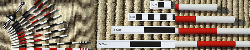
Archaeology photography scales available for archaeologists and museums.
Please view the different scale sets and send an email with quantities and delivery address to:
adam@adam-stanford.co.uk
PHOTOGRAPHY ARCHIVE
|